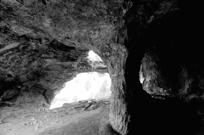
Wind Cave Trail is roughly a 3.7 mile hike out and back in the Logan Canyon, a short drive from Logan, Utah. The trail features a limestone cave at the top with stunning views along the way and at the top.
The trail is rated moderate and is primarily used for hiking. Dogs are also able to use this trail and are supposed to be kept on leash.
Also known as the Witch’s Castle, this interesting formation provides a clear view of what’s called China Wall.

The hike starts about 5.3 miles up Logan Canyon National Scenic Byway, near the Guinavah-Malibu Campground. The trailhead is on the left side of the road as you are driving up-canyon. From there you hike up the ridge to the northwest, into the forest.


Even though it is still technically winter (and early March), the clear skies and the sun made the hike up pretty warm, especially because we started the hike in the middle of the day around 2pm. It was 56 degrees F at the trailhead. The shaded and snowy patches along the way provided warmth relief.

The hike is pretty steep with a steady elevation gain of about 950 feet. It’s definitely a good workout but possible for anyone in good health. We saw families with toddlers (end even babies being carried), couples, groups of young people, runners, dogs of all sizes, and even an obviously pregnant woman.

This stunning view was available to us in the middle of the hike.


If you’re lucky during this hike, you could come across some species of plants not found anywhere else in the world, like Maguire’s primrose or Maguire’s rockcress.

The section of the hike in the photo above felt quite precarious. The path was very thin and uneven and it was next to a very steep cliff, one where you would not want to fall into.


How do you think these caves formed? If you guessed by wind erosion, you should read on.
According to the info board at the trailhead: “the formation of Wind Cave began far underground as water seeped through cracks deep within layers of limestone rock. Over long periods of time, the water slowly dissolved the limestone creating large, below ground caverns. More recently, the downward cutting Logan River exposed the caves. The arches we see today were created as water continues to erode the limestone formation from both ends of the cavern.”


Even though the trail is supposed to be pretty popular and there were lots of cars parked by the trailhead, the hike didn’t feel crowded. We had plenty of space behind and in front of us and at the cave there were only 6 people including us when we got there.
It took us about 3 hours to hike up and down with a couple water breaks on the way up, a few photo stops, and long moments of chilling in the cave. It took us 1 hour to hike the way back. We didn’t time our trek on the way up but it definitely took us longer than that.
I do recommend this hike. I’d love to do it again when the leaves are turning in the fall!
Wind Cave Trail Info:
Difficulty: Moderate
Trailhead: Across Highway 89 from Guinavah-Malibu Campground (GPS: N41°45′747″ W111°42′212″) in Logan Canyon
Elevation Start/Gain: 5100 feet/980 feet
Trailhead: (41.759486, -111.709508)
Parking/Facilities: Park on the North side of the road, the trail is well marked. No bathroom so go at the ranger station just before you go up the canyon.
Have you done this hike? Which has been your favorite hike?

So close to me! Thank you! I will check this one out! 🙂 Beautiful photos.
LikeLike
Thanks! And definitely check it out if it’s near you.
LikeLike
Great post.
LikeLike
Thank you.
LikeLike
Great post.
LikeLike
Thank you.
LikeLike
There is so much natural beauty in Utah, and except for a tiny sliver around Monument Valley, I have yet to experience any of it. I’ll add this place to the list. 🙂
LikeLike